Types of Orbits
What are Orbits?
Orbits are the paths that objects follow around celestial bodies in a repeating motion due to gravity. For example, the Moon orbits the Earth, and the Earth orbits the Sun. This means the Moon is in a constant orbit around the Earth, while the Earth is in a constant orbit around the Sun. The orbiting objects are called satellites. Satellites can be both natural, such as planets and asteroids, or artificial. Man-made satellites are used for various purposes such as communication, weather monitoring, navigation, and scientific research.
There are different types of orbits, each with its own challenges and advantages. Here are a few examples:
Low Earth Orbit (LEO):
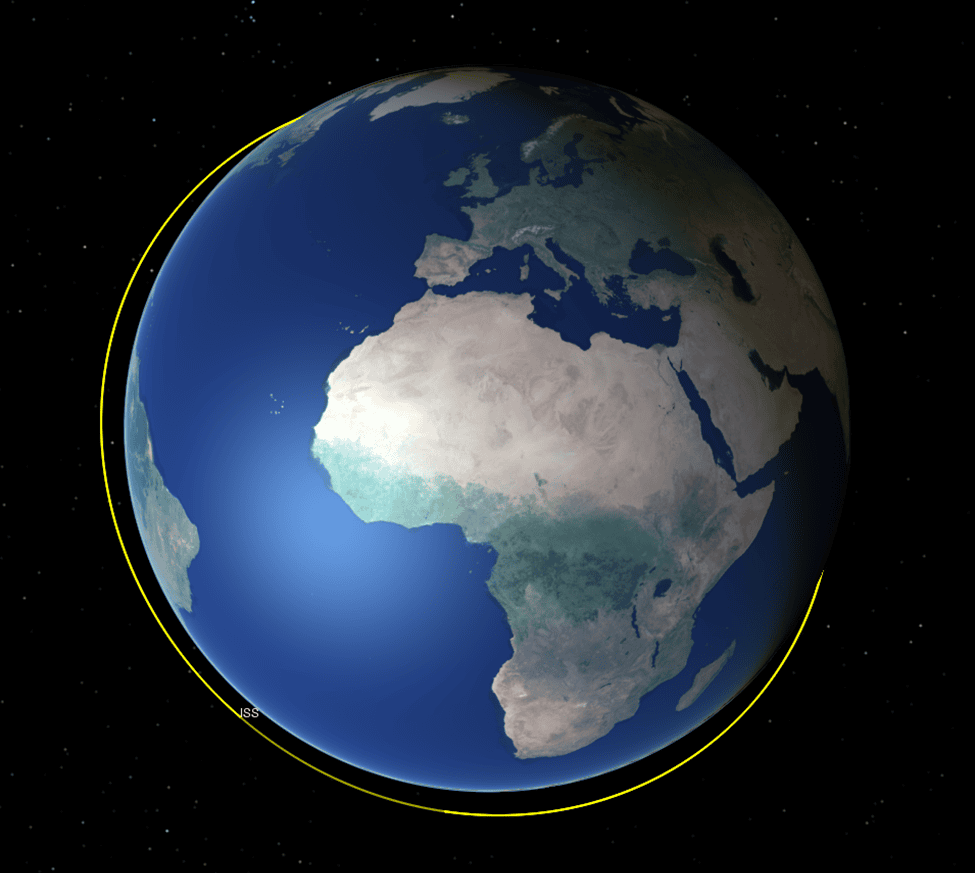
The Low Earth Orbit (LEO) is often used for satellite imaging and international space stations due to its proximity to the surface of the Earth. Satellites in LEO are positioned between 160 to 2,000 km above Earth, and this range significantly affects their behavior. For instance, satellites closer to 160 km travel at a speed of approximately 7.8 km/s, allowing them to complete a full orbit around Earth every 66 minutes. However, satellites at the upper end of this range, closer to 2,000 km, move slightly slower, completing an orbit in 127 minutes due to decreased gravitational pull and atmospheric drag. Satellites in this orbit do not follow a fixed path, which makes this region useful for telecommunications.
Satellites in LEO typically operate below the region where the Van Allen belts have the most intense radiation, helping them avoid the severe effects of solar storms. However, satellites in this orbit experience orbital decay over time, which is the loss of altitude due to environmental factors. Additionally, LEO is densely populated with space debris traveling at the same speed as satellites. Collisions with this high-energy debris could have catastrophic consequences, generating even more debris—a phenomenon known as “Kessler Syndrome”.
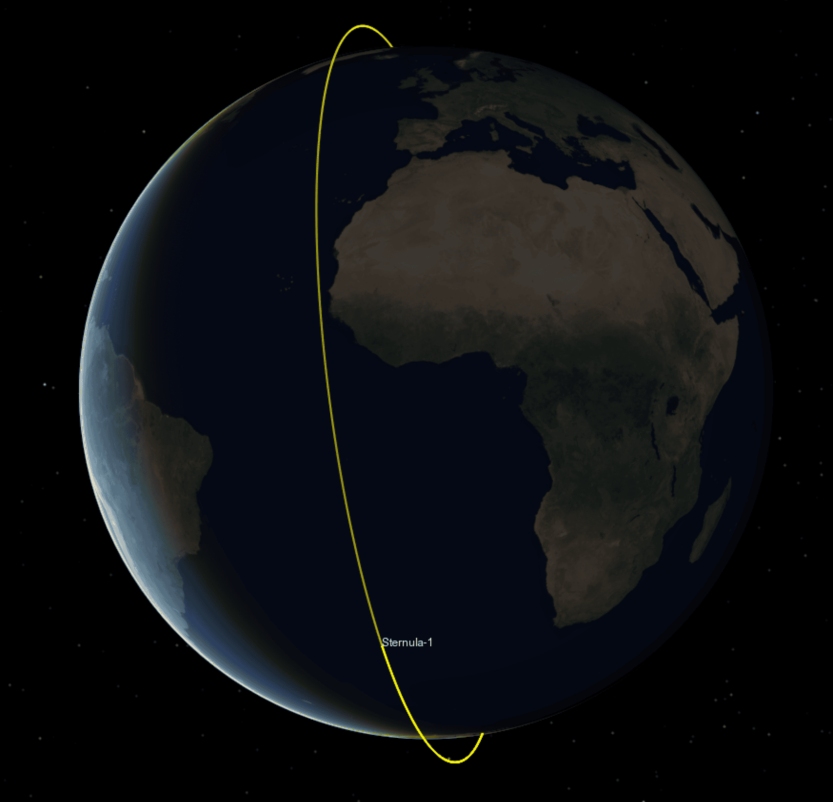
One notable satellite in this orbit is Sternula-1, which follows a polar north path 500 km from the surface of the Earth. Sternula-1 is the first of a planned 65-satellite constellation designed to provide VHF Data Exchange System (VDES, also known as AIS 2.0) coverage for maritime safety and security.
Geostationary Orbit (GEO):
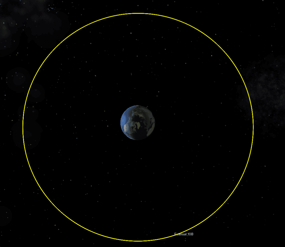
The Geostationary Orbit (GEO) is mostly used for weather monitoring and telecommunications. In contrast to LEO, GEO satellites are positioned 35,786 km from Earth. Satellites in GEO travel at a speed of 3 km/s in a fixed position relative to Earth’s rotation. These satellites are typically not inclined, meaning they follow the equator and always point down towards the same spot on Earth.
Satellites in higher orbits, such as GEO, and astronauts on space missions, need to be cautious about solar activity. They are more likely to experience direct impacts from solar particles and radiation, which can affect their systems and health.
Due to their high altitude, GEO satellites cover large portions of the Earth, requiring fewer satellites for almost global coverage, making this orbit efficient for telecommunications. However, GEO primarily covers equatorial regions and is less effective for higher latitudes, where locations in far northern or southern regions are at the edge of the satellite’s field of view.
Graveyard Orbit:
Like any other machine, a satellite has a limited lifespan. There are currently thousands of satellites orbiting the planet at different altitudes. So, what happens when satellites lose their function?
The Graveyard Orbit, also known as the Junk or Disposable Orbit, serves as the final resting place for some satellites. Smaller satellites in lower orbits (such as LEO) are often lowered, and they gradually descend back to Earth. Atmospheric friction causes these satellites to burn up and disintegrate before re-entry. This process takes around 25 years, known as the “25-year rule“. However, the European Space Agency (ESA) recommends that satellites re-enter within five years after the end of their operations or be moved to a graveyard orbit to prevent collisions and space debris accumulation.
Larger satellites in lower orbits may not completely burn up before reaching Earth. In such cases, they undergo a controlled deorbit procedure, where their altitude is decreased until they fall into a remote region called the spacecraft cemetery, located in the southern Pacific Ocean east of New Zealand.
For satellites in higher orbits, such as GEO, slowing down for re-entry is impractical due to the significant fuel required and associated costs, which would shorten their operational lifespan. It takes about 100 times more fuel to perform a re-entry than to simply raise the orbit to a Graveyard Orbit, located approximately 300 km above GEO. At this altitude, there is no atmospheric drag, drastically reducing the risk of orbital decay and collision with operational satellites. Once in this orbit, the satellite’s systems are shut down, and the satellites are left to orbit in the Graveyard orbit.
The GEO and the Graveyard orbits are more likely to be equatorial orbits. Meaning that their path will follow the Equator all along. This aspect is defined by the inclination of the orbit, one of the 6 Keplerian elements. An equatorial orbit has an inclination close to 0°. On the other hand, orbits can be inclined to achieve different objectives.
Polar orbits
A polar orbit is an orbit with an inclination close to 90°. With such an inclination, the satellite passes over the poles of the Earth, granting it the name “polar orbit”. Unlike equatorial orbits, polar orbit can cover larger portions of the Earth, with higher latitudes, both North and South. This is extremely useful when it comes to gathering or sending information all over the planet, when the altitude does not permit to see enough.
Sweeping over all the latitudes is the reason why intelligence satellites – or spy satellites – fly in polar orbit and low altitude to take photographs or send and receive signals with better accuracy.
Achieving a polar orbit is more complicated than an equatorial orbit. In fact, when launching, rockets use the rotation of the Earth as sling-shot effect. This is the reason why space agencies launch their rockets as close to the Equator as possible: the European launch pad is in Kourou, French Guiana, the American launch pad is in Cape Canaveral, Florida, both being close to the Equator. Therefore, going sideway or even backward requires far more energy for it is not the natural movement of the Earth.
Sun-synchronous orbits
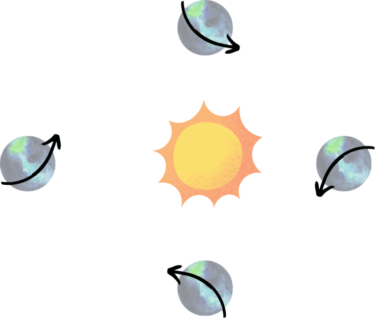
A sun-synchronous orbit (SSO) is an orbit that will always show the same pattern to the Sun. A satellite in SSO will always have the same ratio of sunlight/eclipse and have the same Local Time of Ascending Node (LTAN), which is the Local Time it is when the satellite crosses the Equator (Node) on its way North (Ascending).
To achieve an SSO, satellites must have the correct Keplerian elements so that their precession of Right Ascension of the Ascending Node (RAAN) matches the Earth’s. This is done by taking advantage of the J2 perturbation: a perturbation caused by the oblateness of the Earth.

The precession of the RAAN (Ω) depends on the semi-major axis (a), the eccentricity (e) and inclination (i) of the orbit.
Our satellite Sternula-1 is flying in a sun-synchronous orbit. With the correct set of Keplerian elements, to have consistent day time in order to recharge the batteries properly and to estimate the amount of radiation the satellite will receive throughout its lifetime with better accuracy.
Molniya Orbit:
The Molniya Orbit is primarily used for telecommunications and television broadcasting, especially in high-latitude regions. It was pioneered by Russian communication satellites in the 1960s.
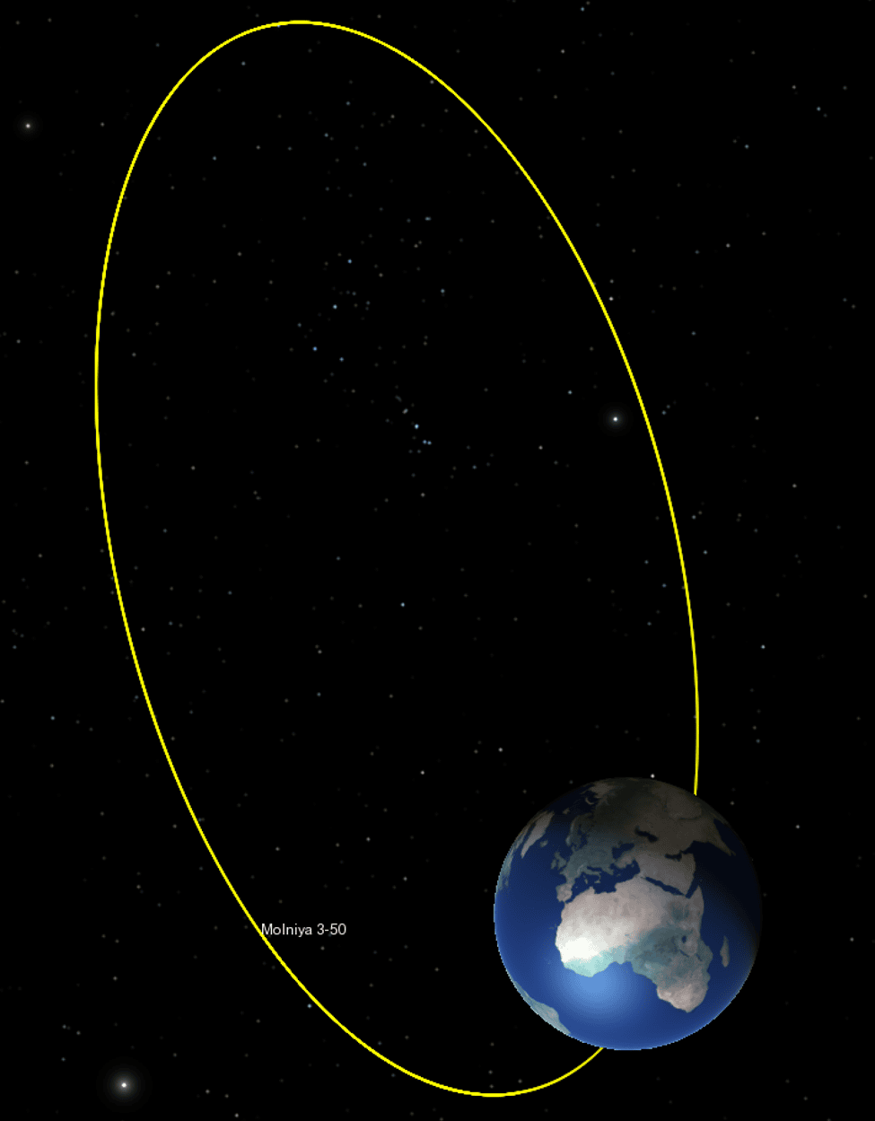
The Molniya Orbit is highly elliptical, with an apogee located 63.4 degrees north of the equator at an altitude of approximately 40,000 km. It is classified as a “frozen orbit“, meaning it has the optimal inclination to prevent the precession of the argument of perigee. This inclination allows the orbit to take advantage of the J2 perturbation to stabilize the satellite’s path.
The altitude of the Molniya Orbit varies between 600 km and 40,000 km, giving it the correct semi-major axis to complete two revolutions per day, as described by Kepler’s third law. The satellite moves fastest at the lowest point of its orbit (the perigee) and slowest at the highest point (the apogee). This allows the satellite to spend most of its orbit covering high-latitude regions such as northern Europe, Greenland, Canada, and Russia, in contrast to GEO, which mainly covers equatorial regions.
Satellites in the Molniya Orbit complete a half-orbit every 12 hours, passing through the Van Allen radiation belt four times daily. To maintain permanent coverage over Russian territory, a constellation of three satellites is required, with each satellite providing coverage for an 8-hour period.
Published on 22/11/2024, Written by: Cyriaque Guillot, Veronika-Karen Mbaha Lunakind


